Maps of the
Buenos Aires West Mission |
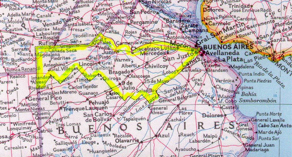
The Argentina Buenos Aires West Mission originates from Capital Federal, and extends to the west touching the border of La Pampa, the next Argentina Province. It is bordered North by the Province of Santa Fe and the Buenos Aires North and the South Mission and Bahia Blanca Mission on the south. Below are some maps of the mission.

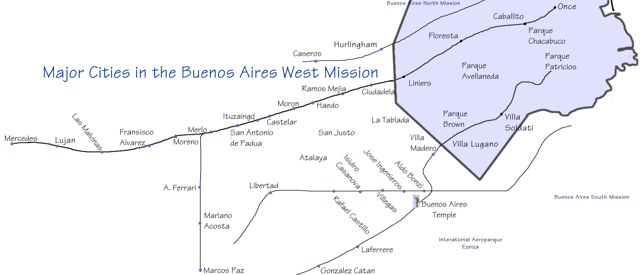
From Buenos Aires to Moreno is generally considered "Greater Buenos Aires." This area of the city is mostly suburban. After you get beyond this area, the towns are further apart, and although each town is well developed, they separated one from another by farms, personal estates (quintas), and vast flat expanses. The train ride from Moreno to Mercedes takes approximately 2.5 hours. Mission cities in the campo (countryside) are not included on this map. Click Here for a printable version of this map.

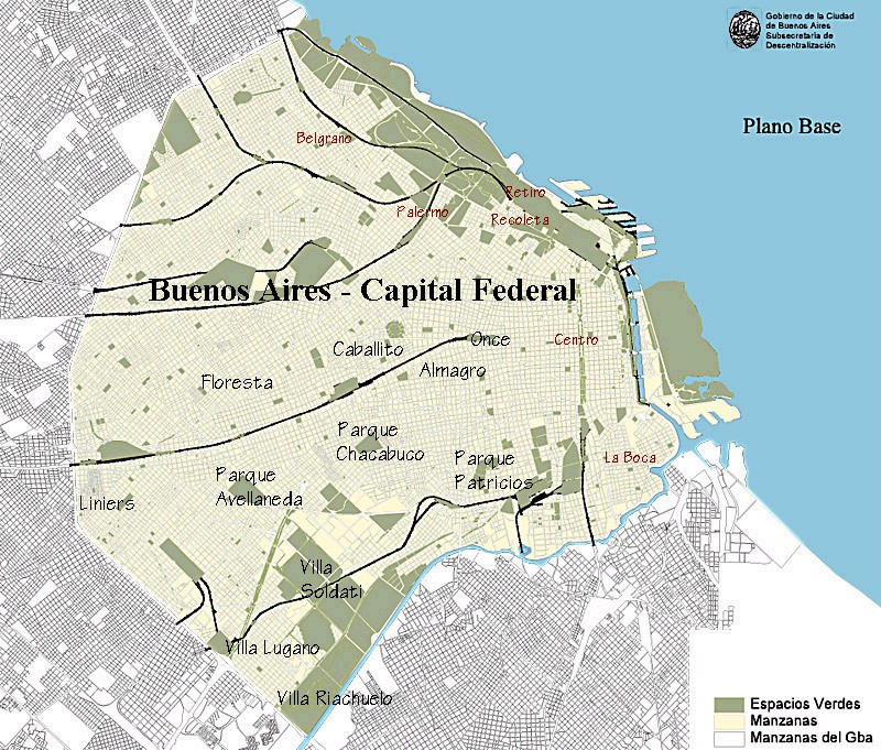
This is a map of the capitol city of Buenos Aires or Capital Federal. The neighborhoods labelled in black were once part of the Buenos Aires West Mission. Almagro, Parque Chacabuco and Parque Patricios now belong to the Congreso Stake, which is in the North Mission. If you look at the detail map, (click on the map) the neighborhoods labeled in brown are other areas of interest in the city and to the missionaries.

|

